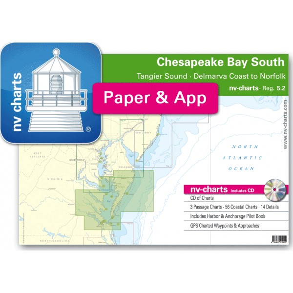
USA REG.5.2 Chesapeake Bay South, Tangier Sound, Delmarva Coas...


nv-charts • Region 5.2 Chesapeake Bay South, Tangier Sound, Delmarva Coast to Norfolk
• CD with Charts
• 3 Passage Charts - 56 Coastal Charts - 14 Details
• GPS Charted Waypoints & Approaches
Practical to use and accurate in the information and data published: This is the basic concept with which we have developed the nv-charts and the Harbor & Anchorage Pilot Books.
• this Chart Kit is based on NOAA data with a new layout, clear cartography and international chart standards
• depths and heights are charted in feet
• north up chart orientation
• channel markers in red and green
• unique color differences, blue for the 6 ft and 18 ft dephts, and green for exposed tidal areas
• contour lines for 12 ft and 30ft depths
• under water reefs are clearly marked with a light green color and the reef above water in darker green
• variable shoals marked in grey-blue
• lighthouses illustrate their light characteristics for better identification
• seaworthy chart layout - perfect chart flow from one chart to the next
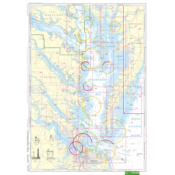
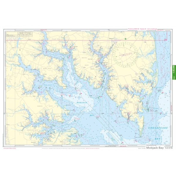
• standardized chart scales - passage charts 1:340,000 – coastal charts 1:45,000 and detail charts 1:25,000 or less
• waypoints with latitudes and longitudes for GPS input
• recommended courses with distances
• arrow-symbols show buoyage direction
• tide information on each chart
Passage Charts
C0 Chesapeake Bay · New York to Cape Fear 1: 1,300,000
C1 Chesapeake Bay · South 1: 340,000
C2 Cape May to Great Machipongo Inlet 1: 340,000
Coastal Charts
C3 Taylors Island to Point Lookout 1: 100,000
C4 Tangier Sound · Pocomoke Sound 1: 100,000
C5 Point Lookout to Rappahannock River 1: 100,000
C6 Rappahannock River to Cape Charles 1: 100,000
C7 Chesapeake Bay Entrance 1: 100,000
C8 Cape Charles to Wachapreague Inlet 1: 100,000
C9 Wachapreague Inlet to Chincoteague 1: 100,000
C10 Chincoteague to Fenwick Island 1: 100,000
C11 Great Wicomico River 1: 45,000
C12 Ball Neck to Stingray Point 1: 45,000
C13 Rappahannock River · Corrotoman River 1: 45,000
C14 Rappahannock River · Urbanna to Sharps 1: 45,000
C15 Rappahannock River · Sharps to Tappahannock 1: 45,000
C16 Rappahannock River · Tappahannock to Leedstown 1: 45,000
C17 Rappahannock River · Leedstown to Fredericksburg 1: 45,000
C18 Piankatank River 1: 45,000
C19 Mobjack Bay 1: 45,000
C20 York River Entrance 1: 45,000
C21 York River · Yorktown to Purtan Bay 1: 45,000
C22 York River · Purtan Bay to West Point 1: 45,000
C23 Mattaponi and Pamunkey Rivers 1: 45,000
C24 Hampton Roads · Norfolk 1: 45,000
C25 Nansemond River to Suffolk 1: 45,000
C26 James River · Pig Point to Burwell Bay 1: 45,000
C27 James River · Burwell Bay to Jamestown 1: 45,000
C28 James River · Chickahominy River 1: 45,000
C29 James River · Claremont to Eppes Island 1: 45,000
C30 James River · Eppes Island to Richmond 1: 45,000
C31 Cape Henry 1: 45,000
C32 Honga River · Hooper Strait 1: 45,000
C33 Tangier Sound · Fishing Bay · Nanticoke Entrance 1: 45,000
C34 Nanticoke River · Hatcrown Point to Sharptown 1: 45,000
C35 Nanticoke River · Sharptown to Seaford 1: 45,000
C36 Wicomico River 1: 45,000
C37 Tangier Sound · Hooper Strait to Solomons Lump 1: 45,000
C38 Tangier Sound · Manokin River 1: 45,000
C39 Tangier Sound · Solomons Lump to Tangier Island 1: 45,000
C40 Pocomoke Sound 1: 45,000
C41 Pocomoke River 1: 45,000
C42 Watts Island to Sandy Point 1: 45,000
C43 Sandy Point to Old Town Neck 1: 45,000
C44 Old Town Neck to Kiptopeke Beach 1: 45,000
C45 Cape Charles to Ship Shoal Inlet 1: 45,000
C46 Ship Shoal Inlet to Great Machipongo Inlet 1: 45,000
C47 Great Machipongo Inlet to Quinby Inlet 1: 45,000
C48 Quinby Inlet to Wachapreague Inlet · Burtons Bay 1: 45,000
C49 Burtons Bay to Cat Creek 1: 45,000
C50 Chincoteague Inlet 1: 45,000
C51 Chincoteague Bay · South 1: 45,000
C52 Chincoteague North & Sinepuxent Bays 1: 45,000
C53 Ocean City Inlet to South Bethany 1: 45,000