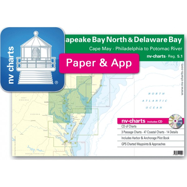
USA REG.5.1 Chesapeake Bay North & Delaware Bay, Cape May,...


nv-charts • Region 5.1 Chesapeake Bay North & Delaware Bay, Cape May, Philadelphia to Potomac River
• CD with Charts
• 3 Passage Charts - 47 Coastal Charts - 14 Details
• GPS Charted Waypoints & Approaches
Practical to use and accurate in the information and data published: This is the basic concept with which we have developed the nv-charts and the Harbor & Anchorage Pilot Books.
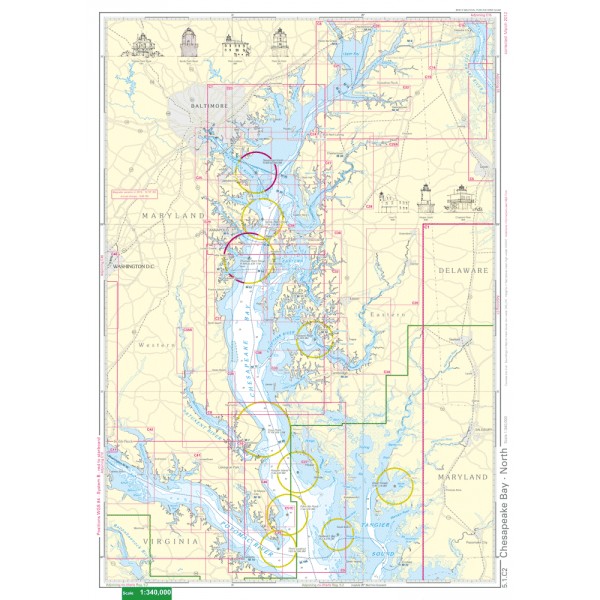
• this Chart Kit is based on NOAA data with a new layout, clear cartography and international chart standards
• depths and heights are charted in feet
• north up chart orientation
• channel markers in red and green
• unique color differences, blue for the 6 ft and 18 ft dephts, and green for exposed tidal areas
• contour lines for 12 ft and 30ft depths
• under water reefs are clearly marked with a light green color and the reef above water in darker green
• variable shoals marked in grey-blue
• lighthouses illustrate their light characteristics for better identification
• seaworthy chart layout - perfect chart flow from one chart to the next
• standardized chart scales - passage charts 1:340,000 – coastal charts 1:45,000 and detail charts 1:25,000 or less
• waypoints with latitudes and longitudes for GPS input
• recommended courses with distances
• arrow-symbols show buoyage direction
• tide information on each chart
Passage Charts
C0 New York to Cape Fear 1: 1,300,000
C1 Cape May to Great Machipongo Inlet 1: 340,000
C2 Chesapeake Bay · North 1: 340,000
Coastal Charts
C3 Cape May to Fenwick Island 1: 100,000
C4 Delaware Bay · South 1: 100,000
C5 Delaware Bay · North 1: 100,000
C6 Chesapeake Bay to Delaware River 1: 100,000
C7 Chesapeake Bay · North of Annapolis 1: 100,000
C8 Thomas Point Shoal to Taylors Island 1: 100,000
C9 Taylors Island to Point Lookout 1: 100,000
C10 Potomac River · South 1: 100,000
C11 Potomac River · North 1: 100,000
C12 Indian Bay 1: 45,000
C13 Cape Henlopen 1: 45,000
C14 Chesapeake & Delaware Canal · East 1: 45,000
C15 Delaware River · Penns Neck to Grubbs Landing 1: 45,000
C16 Delaware River · Grubbs Landing to Philadelphia 1: 45,000
C17 Delaware River · Philadelphia 1: 45,000
C18 Delaware River · Tacony to Trenton 1: 45,000
C19 Chesapeake & Delaware Canal · West 1: 45,000
C20 Havre de Grace to Howell Point 1: 45,000
C21 Howell Point to Pooles Island 1: 45,000
C22 Sassafras River 1: 45,000
C23 Gunpowder River 1: 45,000
C24 Patapsco River Junction 1: 45,000
C25 Baltimore Approach 1: 45,000
C26 North of Chesapeake Bay Bridge 1: 45,000
C27 Chester River Approach 1: 45,000
C28 Chester River · North 1: 45,000
C29 Annapolis Approach 1: 45,000
C30 Eastern Bay 1: 45,000
C31 Thomas Point to Holland Point 1: 45,000
C32 Miles River · South 1: 45,000
C33 Choptank River Approach 1: 45,000
C34 Choptank River · Middle 1: 45,000
C35 Choptank River · North 1: 45,000
C36 Little Choptank River 1: 45,000
C37 Patuxent River Approach 1: 45,000
C38 Patuxent River 1: 45,000
C39 Potomac River · Point Lookout to Sandy Point 1: 45,000
C40 Potomac River · Lawson Point to Coles Point 1: 45,000
C41 Potomac River · Coles Point to Wicomico River 1: 45,000
C42 Potomac River · Wicomico River to Potomac Beach 1: 45,000
C43 Potomac River · Potomac Beach to Somerset Beach 1: 45,000
C44 Potomac River · Somerset Beach to Shipping Point 1: 45,000
C45 Potomac River · Shipping Point to Whitestone Point 1: 45,000
C46 Potomac River · Whitestone Point to Washington, D.C. 1: 45,000