USA REG.4.1 Long Island South & New Jersey Coast, New York...


nv-charts • Region 4.1 Long Island South & New Jersey Coast, New York, Shinnecock to Cape May
• CD with Charts
• 3 Passage Charts - 35 Coastal Charts - 12 Details
• GPS Charted Waypoints & Approaches
Practical to use and accurate in the information and data published: This is the basic concept with which we have developed the nv-charts and the Harbor & Anchorage Pilot Books.
• this Chart Kit is based on NOAA data with a new layout, clear cartography and international chart standards
• depths and heights are charted in feet
• north up chart orientation
• channel markers in red and green
• unique color differences, blue for the 6 ft and 18 ft dephts, and green for exposed tidal areas
• contour lines for 12 ft and 30ft depths
• under water reefs are clearly marked with a light green color and the reef above water in darker green
• variable shoals marked in grey-blue
• lighthouses illustrate their light characteristics for better identification
• seaworthy chart layout - perfect chart flow from one chart to the next
• standardized chart scales - passage charts 1:340,000 – coastal charts 1:45,000 and detail charts 1:25,000 or less
• waypoints with latitudes and longitudes for GPS input
• recommended courses with distances
• arrow-symbols show buoyage direction
• tide information on each chart
Passage Charts
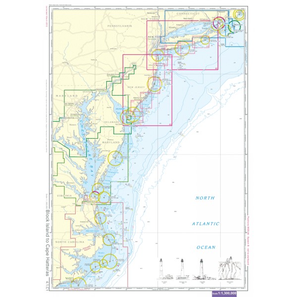
C1 Block Island to Cape Hatteras 1: 1,300,000
C2 Long Island South Coast 1: 340,000
C3 Sandy Hook to Cape May 1: 340,000
Coastal Charts
C4 Shinnecock Inlet to Narrow Bay 1: 80,000
C5 Narrow Bay to Fire Island Inlet 1: 80,000
C6 Fire Island Inlet to East Rockaway Inlet 1: 80,000
C7 Approaches to New York 1: 80,000
C8 Ocean Grove to Barnegat Bay 1: 80,000
C9 Barnegat Bay · Seaside Park to Beach Haven 1: 80,000
C10 Beach Haven to Gr. Egg Hbr. Inlet · Altantic City 1: 80,000
C11 Gr. Egg Hbr. Inlet to Hereford Inlet 1: 80,000
C12 Cape May 1: 80,000
C13 Shinnecock Bay 1: 40,000
C14 Shinnecock Bay to Moriches Inlet 1: 40,000
C15 Moriches Inlet to Watch Hill 1: 40,000
C16 Watch Hill to Saltaire 1: 40,000
C17 Fire Island Inlet 1: 40,000
C18 Jones Beach Island 1: 20,000
C19 Jones Inlet 1: 20,000
C20 Hempstead Bay 1: 20,000
C21 Jamaica Bay East 1: 20,000
C22 Jamaica Bay West 1: 20,000
C23 Rockaway Inlet 1: 20,000
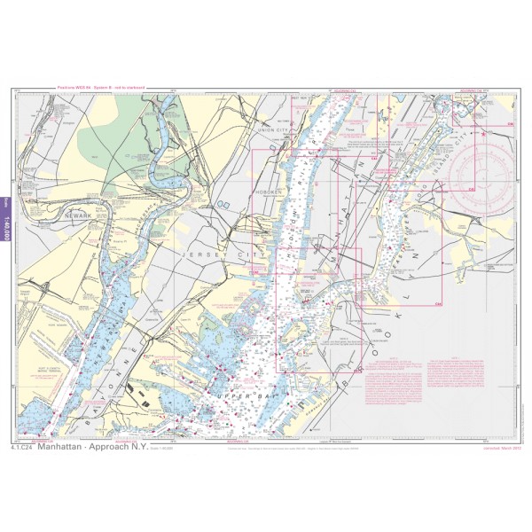
C24 Manhattan · Approach N.Y. 1: 40,000
C25 Upper Bay · Approach N.Y. 1: 40,000
C26 Ambrose Channel · Approach N.Y. 1: 40,000
C27 Staten Island · Lower Bay 1: 40,000
C28 Sandy Hook 1: 40,000
C29 Long Branch to Shark River Inlet 1: 40,000
C30 Shark River Inlet to Mantoloking 1: 40,000
C31 Mantoloking to Barnegat Bay 1: 40,000
C32 Barnegat Inlet 1: 40,000
C33 Little Egg Harbor 1: 40,000
C34 Great Bay 1: 40,000
C35 Atlantic City to Ocean City 1: 40,000
C36 Ocean City to Sea Isle City 1: 40,000
C37 Sea Isle City to Hereford Inlet 1: 40,000
C38 Cape May 1: 40,000
Details
C39A Great Bay / Mullica River 1: 40,000
C39B Absecon Inlet 1: 20,000
C39C Shark River 1: 20,000
C39D Manasquan Inlet 1: 20,000
C40 Cape May Harbor 1: 10,000
C41 Governors Island · Brooklyn Bridge 1: 10,000
C42 Hudson River · Battery to Castle Pt 1: 10,000
C43 Hudson River · Weehawken 1: 10,000
C44 Hudson River · Williamsburg Bridge to Newton Creek 1: 10,000
C45 East River · Hell Gate · Roosevlet I. 1: 10,000
C46 East River · Hell Gate to Hunts Pt 1: 10,000
C47 East River · Flushing Bay to Whitestone Bridge 1: 10,000