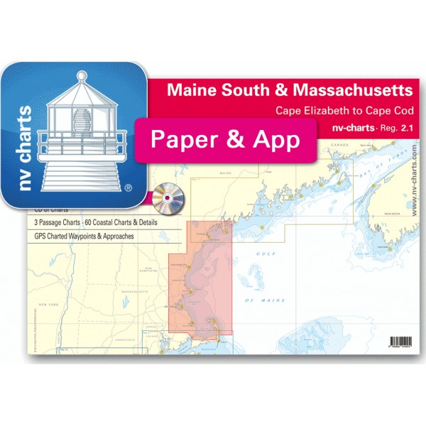
USA REG.2.1 Maine South & Massachusetts Bay, Cape Elizabet...


nv-charts • Reg. 2.1 Maine South & Massachusetts
• CD of Charts
• 3 Passage Charts - 60 Coastal Charts - Details
• GPS Charted Waypoints & Approaches
Practical to use and accurate in the information and data published: This is the basic concept with which we have developed the nv-charts and the Harbor & Anchorage Pilot Books.
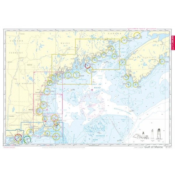
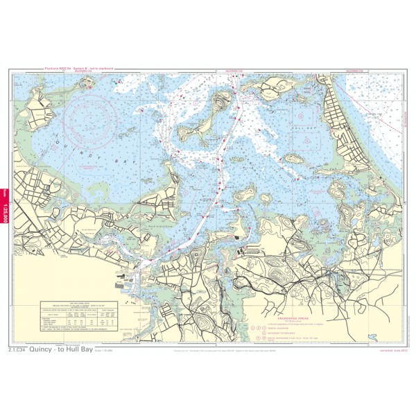
• this Chart Kit is based on NOAA data with a new layout, clear cartography and international chart standards
• depths and heights are charted in feet
• north up chart orientation
• channel markers in red and green
• unique color differences, blue for the 6 ft and 18 ft dephts, and green for exposed tidal areas
• contour lines for 12 ft and 30ft depths
• under water reefs are clearly marked with a light green color and the reef above water in darker green
• variable shoals marked in grey-blue
• lighthouses illustrate their light characteristics for better identification
• seaworthy chart layout - perfect chart flow from one chart to the next
• standardized chart scales - passage charts 1:340,000 – coastal charts 1:45,000 and detail charts 1:25,000 or less
• waypoints with latitudes and longitudes for GPS input
• recommended courses with distances
• arrow-symbols show buoyage direction
• tide information on each chart
Passage Charts
C1 Gulf of Maine 1: 1,300,000
C2 Bigelow Bight 1: 340,000
C3 Massachusetts Bay 1: 340,000
Coastal Charts and Details
C4 Halfway Rock to Cape Elizabeth 1: 80,000
C5 Cape Elizabeth to Cape Arundel 1: 80,000
C6 Cape Arundel to Isles of Shoals 1: 80,000
C7 Isles of Shoals to Cape Ann Lt. 1: 80,000
C8 Cape Ann Lt. to Broad Sound 1: 80,000
C9 Broad Sound to New Inlet 1: 80,000
C10 New Inlet to Manomet Pt. 1: 80,000
C11 Manomet Pt. to Billingsgate Shoal 1: 80,000
C12 Cape Cod Bay · East 1: 80,000
C13 Portland Hbr Approaches 1: 40,000
C14 Portland Hbr and Vicinity 1: 20,000
C15 Richmond Island to Saco Bay 1: 20,000
C16 Saco River 1: 20,000
C17A Cape Porpoise Harbor 1: 10,000
C17B Kennebunk River 1: 10,000
C17C Wells Harbor 1: 20,000
C17D Perkins Cove 1: 10,000
C18 Portsmouth Harbor 1: 20,000
C19A Piscataqua River 1: 20,000
C19B Continuation to Cape Neddick Harbor 1: 20,000
C19C York Harb~~or 1: 20,000
C20A Isles of Shoals 1: 20,000
C20B Rye Harbor 1: 20,000
C20C Hampton Harbor 1: 30,000
C20D Parker River 1: 20,000
C20E-F Merrimack River Extension 1: 80,000
C21 Merrimack River 1: 20,000
C22 Plum Island Sound 1: 20,000
C23 Ipswich Bay 1: 20,000
C24A Annisquam River · North 1: 10,000
C24B Rockport Harbor 1: 5,000
C24C Manchester Harbor 1: 10,000
C25 Gloucester Harbor 1: 10,000
C26 Rockport Approaches 1: 20,000
C27 Thacher Island and Vicinity 1: 20,000
C28 Gloucester Hbr Approach 1: 20,000
C29 Salem Sound 1: 25,000
C30 Marblehead 1: 25,000
C31 Nahant Bay & Broad Sound 1: 25,000
C32 Boston & Nantasket Roads Approaches 1: 25,000
C33 Boston Harbor 1: 25,000
C34 Quincy - to Hull Bay 1: 25,000
C35 Winthrop Harbor 1: 10,000
C36 Boston Harbor · South 1: 10,000
C36A Mystic River Extension 1: 10,000
C37 Boston Harbor · North 1: 10,000
C38 Cohasset Harbor 1: 10,000
C39A Scituate Harbor 1: 10,000
C39B North River 1: 20,000
C39C Green Harbor 1: 10,000
C40 Duxbury Bay 1: 20,000
C41 Plymouth Harbor 1: 20,000
C42A Cape Cod Canal 1: 40,000
C42B Cape Cod Canal Eastern Approach 1: 20,000
C42C Sesuit Harbor 1: 10,000
C43A Barnstable Harbor 1: 20,000
C43B Wellfleet Harbor 1: 40,000
C44 Provincetown Harbor 1: 20,000