Saisissez un nom de produit
InscriptionDésinscription
Tri --Le moins cherLe plus cherDe A à ZDe Z à AProduits en stock
produits 10152050
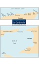
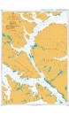
G22 Northeast Aegean SeaScale: 1:275,000 Imray PlansApproaches to Lágos and...
Comparer
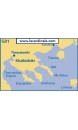
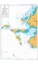
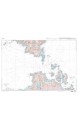
G21 Northwest Aegean SeaScale: 1:275,000 Imray PlansPorta CanalNéa Skioni
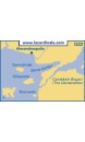
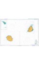
D10 North Coast of Trinidadand Golfo de Paria Scale: Various WGS 84 Imray Caribbean...
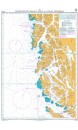
C69 Loch Ryan to Belfast Lough and Strangford LoughScale: 1:90,000 WGS 84 Imray Plans...
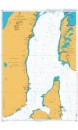
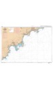
C43 Santander to A CoruñaScale: 1:350,000 WGS 84 Imray Plans included: Santander...
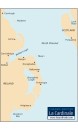
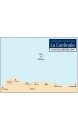
A29 DominicaScale: 1:75,000 WGS 84 Imray Leeward Islands Plans include:...
M35 Sicilian ChannelScale: 1:375 000 WGS 84 Imray A brand new chart of the Sicilian Channel,...
Chart Title: La Reunion to Mauritius and Ile Tromelin Chart Size: 1098 x 749 (mm) Chart...
Chart Title: Kampong Saom and Approaches Chart Size: 654 x 995 (mm) Chart Panel Details
Chart Title: Paso Tortuoso and Canal Jeronimo Chart Size: 742 x 1054 (mm) Chart Panel...
Chart Title: Paso del Hambre to Paso Tortuoso Chart Size: 1076 x 750 (mm) Chart Panel...
Chart Title: Paso Nuevo to Paso Del Hambre Chart Size: 750 x 1100 (mm) Chart Panel...
Chart Title: Estrecho de Magallanes to Canal Trinidad Chart Size: 532 x 761 (mm) Chart...
• Numéro de carte : 7409 • Titre : De la Rade d'Agay à Monaco • Echelle : 1 : 49 700 • Format...
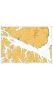
• Numéro de carte : 7024 - INT 3350 • Titre : Bouches de Bonifacio • Echelle : 1 : 51 600 •...
Aucun produit
Expédition 0,00 € Total 0,00 €
Panier Commander
Tous les nouveaux produits
Voir toutes les meilleures ventes