Saisissez un nom de produit
InscriptionDésinscription
Tri --Le moins cherLe plus cherDe A à ZDe Z à AProduits en stock
produits 10152050
Natural Scale 300000North Limit East Limit South Limit West Limit 22° 42'.00N 71° 14'.00W 19° 39'.00N 73° 29'.00W
Comparer
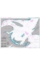
Natural Scale 300000 North Limit East Limit South Limit West Limit 22° 19'.00N 69° 25'.00W 19° 15'.00N 71° 40'.00W
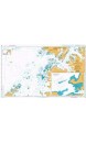
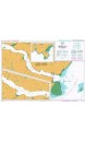
Natural Scale 350000 North Limit East Limit South Limit West Limit 61° 25'.00N 0° 12'.00E 58° 17'.00N 4° 00'.00W
Chart Size 650 x 1100 (mm) Chart Panel Details Panel Name Anvers Island to Renaud Island Natural Scale 150000...
Panel Name Laguna de Chiriqui Area Name Panama - North Coast Natural Scale 75000 North Limit East Limit South...
Panel Name Bahia Almirante Natural Scale 60000 North Limit East Limit South Limit West Limit 9° 30'.00N 82°...
Panel Name Panel A Area Name Panama Canal Natural Scale 35000 North Limit East Limit South Limit West Limit 9°...
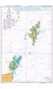
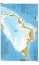
A colour waterproof chart of the Abaco Islands at a scale of 1:171,50021 Plans of harbours and anchorages for the...
Natural Scale 750000 North Limit East Limit South Limit West Limit 50° 27'.50N 57° 20'.00W 45° 15'.00N 67° 30'.00W
North Limit East Limit South Limit West Limit 48° 16'.20N 69° 31'.97W 48° 02'.00N 70° 01'.97W
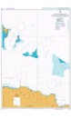
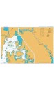
M9 South SardegnaScale: 1:255,000 WGS 84 Imray Plans: Approaches to Arbatax
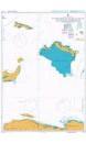
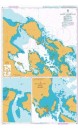
M8 North SardegnaScale: 1:255,000 WGS 84 Imray Plans: La Maddalena Archipelago –...
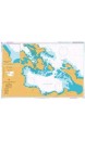
Chart 100 North Atlantic Ocean Passage ChartPassage Chart Scale: 1:7,620,000 WGS 84...
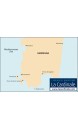
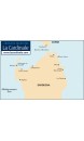
• Echelle : 1 : 1 030 000 • Format : A0 • Système géodésique : WGS84
Aucun produit
Expédition 0,00 € Total 0,00 €
Panier Commander
Tous les nouveaux produits
Voir toutes les meilleures ventes