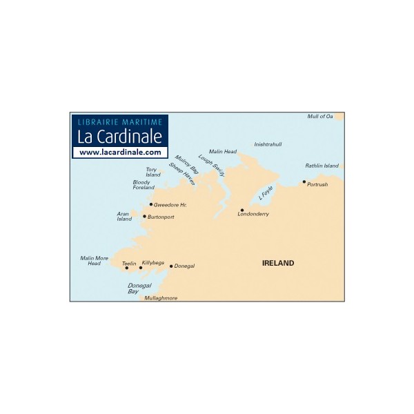
Donegal Bay to Rathlin Island


C53 Donegal Bay to Rathlin Island
Scale: 1:200,000 WGS 84
Imray
Plans:
Portrush
Lough Swilly
Mulroy Bay
Sheep Haven
Gweedore Harbour & Approaches
Sound of Aran & Burtonport
Teelin Harbour
Killybegs Harbour
Mullaghmore Bay
2010 edition updated throughout and latest survey data applied. Depths updated in Mulroy Bay; New coastline and depths shown on Killybegs Harbour plan; Teelin Harbour and Killybegs Harbour plans adjusted to improve WGS 84 positional accuracy.